
This work by New American History is licensed under a Attribution-NonCommercial-ShareAlike 4.0 (CC BY-NC-SA 4.0) International License. Permissions beyond the scope of this license may be available at newamericanhistory.org.
Redlining and Housing Discrimination (Part 2)
New American History, Digital Scholarship Lab
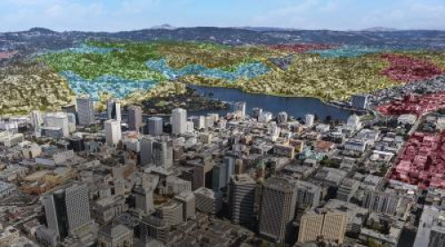
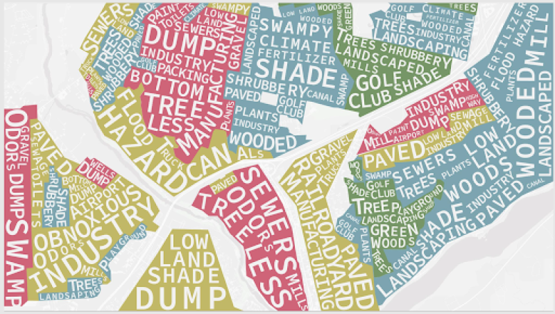
This digital StoryMap connects present-day environmental inequalities to redlining policies of the 1930s.
Use the scroll bar to slowly scroll through the animation, taking time to carefully read each textbox as a map-shaped word cloud begins to appear.
Take a few minutes to explore one of the four case studies included on the map to help better understand the long-term effects of redlining policies on urban neighborhoods in the modern era. You may scroll through the StoryMap to select one.
Look for examples where African American communities had limited access to public transportation, clean water and air, recreational spaces, healthy food, and healthcare services, exacerbating health disparities along racial lines.
Complete this sentence as you think about the way data and historical content are presented on the StoryMap:
I used to think__________ but now I think__________ .
Robert K. Nelson, LaDale Winling, Richard Marciano, Nathan Connolly, et al., “Mapping Inequality,” American Panorama, ed. Robert K. Nelson and Edward L. Ayers, accessed July 7, 2022, https://dsl.richmond.edu/panorama/redlining