
This work by New American History is licensed under a Attribution-NonCommercial-ShareAlike 4.0 (CC BY-NC-SA 4.0) International License. Permissions beyond the scope of this license may be available at newamericanhistory.org.
Gerrymandering and Redistricting
A collaboration with GeoCivics, RetroReport and Untold
View Student Version
Share this page with your students.
NOTE: During the 2025-26 election cycle, several states including Texas, California, and Virginia engaged in various forms of redistricting that are now being litigated. As the landscape around gerrymandering and redistricting is changing rapidly, we have put a PAUSE on any further updates to this learning resource and the corresponding maps until some of the legal challenges are resolved. Please take a few minutes to discuss the dynamic changes occurring in real time around this topic with your students.

Standards
AP U.S. Government and Politics Course Framework:Disciplinary Practice 2.a, d.Disciplinary Practice 3.c.,d.Reasoning Process 2, 4:Unit 2: CON-3.C.1: Unit 5: PMI-5.c:
Common Core Standards: CCSS.ELA-LITERACY.RH.9-10.1, 10.5, 10.7
C-3 Framework Standards for Social Studies:D1.2.9-12. D1.4.9-12.D2.Civ.3.9-12.D2.Civ.4.9-12D2.Civ.8.9-12 D2.Civ.13.9-12 D2.Geo.5.9-12 D2.Geo.8.9-12D2.His.1.9-12D2.His.2.9-12 D2.His.5.9-12 D2.His.12.9-12
EAD RoadmapTheme: A New Government & ConstitutionDesign Challenges: Motivating Agency, Sustaining the Republic; Civic Honesty, Reflective PatriotismDriving Question: CDQ4.4B
National Council for Social Studies:Theme 6: Power, Authority and Governance
National Geography Standards: Standard 1—How to use maps and other geographic representations, tools, and technologies to acquire, process, and report information from a spatial perspective
Teacher Tip: Think about what students should be able to KNOW, UNDERSTAND and DO at the conclusion of this learning experience. A brief exit pass or other formative assessment may be used to assess student understandings. Setting specific learning targets for the appropriate grade level and content area will increase student success.
Suggested Grade Levels: Middle School and High School (6-8, 9-12)
Suggested Timeframe: 3 days, 90 minutes
Suggested Materials: Internet access via laptop, tablet, or mobile device
Key Vocabulary
Apportionment - the process of allocating seats in the House of Representatives to match the changing U.S. population in various political groupings such as states, counties, and districts.
Blockbusting - discriminatory real-estate practice of buying homes from white majority homeowners below market value, based on the implied threat of future decreases in the value of a home during minority integration of previously segregated neighborhoods.
Bipartisan - including members from two political parties or opposing groups
Cartogram - a map that combines statistical information with geographic location.
Census - the official count of a population in a geographic area. The census counts every person living in the United States and its five territories every 10 years. The results are used to determine the number of seats each state will have in the US House of Representatives, and to draw congressional and state legislative districts.
Community of Interest (COI) - geographic areas that share cultural, historic, or economic interests, used to help gather community input in redistricting process.
Cracking - taking one district and dividing it into several pieces, usually in districts where an opponent has many supporters, spreading these supporters out among many districts, denying your opponent a lot of votes. (opposite of packing)
Enumeration clause - clause found in Article I, Section 2, Clause 3 of the U.S. Constitution, also known as the Census clause, states how many members of Congress (the members of the United States House of Representatives) each state may elect, based on the population of that state. This is updated every 10 years based on the most recent Census data.
Gerrymandering - the intentional drawing of a district map or plan to advantage or disadvantage a specific group.
Packing - the process of drawing district lines and cramming opponents into as few districts as possible. If more districts equal more votes, the fewer the districts there are, the fewer votes the opposition party will get. Packing, then, decreases the opponent's voter strength and influence. (opposite of cracking)
Partisan - including members or beliefs of only one political party or group
Population - all the inhabitants of a particular town, area, or country
Ranked-choice voting - electoral system allows voters to rank candidates by preference, meaning they can submit ballots that list not only their first-choice candidate for a position but also their second, third, and so on. Currently used in Maine, New York City, and countries including Australia and New Zealand.
Reapportionment - adjusting the number of seats allocated by voting districts following changes in the most recent Census data each decade, as prescribed by the U.S. Constitution.
Redistricting - the state-by-state process of deciding how to divide up the population geographically, organizing community members into voting districts, determining who represents the people in your state, town, and community.
Redlining - the practice of denying a creditworthy applicant a loan for housing in a certain neighborhood even though the applicant may otherwise be eligible for the loan. The term refers to the presumed practice of mortgage lenders of drawing red lines around portions of a map to indicate areas or neighborhoods in which they do not want to make loans.
Representation - someone who acts or speaks for or in support of another person or group, as in a member of the House of Representatives of a legislative body, such as the U.S. Congress or of a state government.
Special interest groups - people working together to influence government policy to benefit themselves or causes they support.
Read for Understanding
Teacher Tips:
This Learning Resource includes language in the body of the text to help adapt to a variety of educational settings, including remote learning environments, face-to-face instruction, and blended learning. These Learning Resources follow a variation of the 5Es instructional model, and each section may be taught as a separate learning experience, or as part of a sequence of learning experiences. We provide each of our Learning Resources in multiple formats, including web-based and as an editable Google Doc for educators to teach and adapt selected learning experiences as they best suit the needs of your students and local curriculum. You may also wish to embed or remix them into a playlist for students working remotely or independently.
If you are teaching remotely, consider using videoconferencing to provide opportunities for students to work in partners or small groups. Digital tools such as Google Docs or Google Slides may also be used for collaboration. Rewordify helps make a complex text more accessible for those reading at a lower Lexile level while still providing a greater depth of knowledge. Both the teacher and student view of these Learning Resources include the use of Immersive Reader for increased accessibility. External links embedded in the Learning Resources may or may not include this assistive technology.
These Learning Resources were developed in collaboration with the EAD Roadmap project, and use a variety of digital tools and resources. Some of our partners’ resources include Electing the House, a digital scholarship mapping project from the University of Richmond’s American Panorama digital atlas, and GeoCivics, state-based resources from the University of Colorado Colorado Springs to develop skills and knowledge for discussing the electoral apportionment and redistricting process. Due to the delayed releases of the 2020 Census and election data, some maps are still in the process of being updated to reflect the most current data.
A variety of instructional videos are used, including those shared in partnership with RetroReport and Untold History. Other sites worth exploring prior to teaching these ideas and concepts include Fairvote.org, Ballotpedia, Representable.org, Dave’s Redistricting, and NCSL.org.
Instructional strategies used in these Learning Resources include Turn and Talk, 3-2-1 including the optional use of a 3-2-1 podcast listening guide, a Gallery Walk, a Reflective Journal, and Project Zero’s Color, Symbol, Image strategy, and template. Additional templates are provided for students to copy and use as needed. Students will also practice using critical thinking skills including Compare and Contrast, a Paired Reading strategy, and a Primary Source Analysis Tool provided by the Library of Congress.
For Students:
The government uses Census data for a lot of things, but at the top of that list is deciding how many seats each state gets in the U.S. House of Representatives — a process called reapportionment. There are 435 seats in the U.S. House, which are divided amongst the states based on population. States with an increase in population may gain seats, while those with a decrease in population may lose seats. All states retain a minimum of one vote.
Then, that information is used every 10 years to redraw political maps, through a process known as redistricting. This process often becomes politicized, when politicians and special interest groups tactics like Gerrymandering.
Engage:
How is Census data used to determine Congressional representation?
Since the ratification of the U.S. Constitution, Congress has set the number of federal legislators and the number of representatives per state by legislative act. Each state determines whether its members of Congress are elected at large or by geographic district. Currently, all Congressional representatives represent individual geographic districts, but this was not always the case.
Take a few minutes to view this short video, How the Census Changed America, from our friends at Untold History. In the video, listen to find out more information about the history of the census and why enslaved people were only partly favored to be included in certain states, and whether the latest census data gathering is an accurate representation of the modern-day USA.
The Enumeration Clause of the United States Constitution mandates the Census and the process for determining the number of members in the U.S. Congress each decade. Read the text here:
constitution.congress.gov
Turn and talk to an elbow partner, or if working remotely, use a collaborative document such as Google Docs, Google Slides, or Padlet. Your teacher may provide opportunities for collaboration using videoconferencing technology, such as breakout rooms via Zoom or Google Meet.
- How was the Census first administered in the United States, and how has it changed over time?
- Why was the Census first created?
- What obstacles did the early Census takers encounter?
- How were these barriers overcome, or what compromises were made to approve these constitutional mandates?
The government uses Census data for a lot of things, but at the top of that list is deciding how many seats each state gets in the U.S. House of Representatives — a process called reapportionment. There are 435 seats in the U.S. House, which are divided amongst the states based on population. States with an increase in population may gain seats, while those with a decrease in population may lose seats. All states retain a minimum of one vote.
Then, that information is used every 10 years to redraw political maps, through a process known as redistricting.
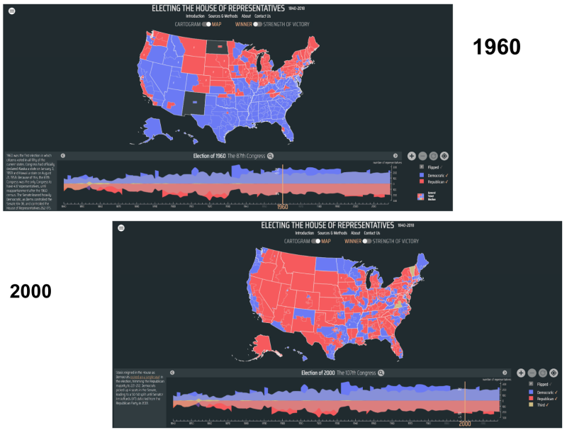
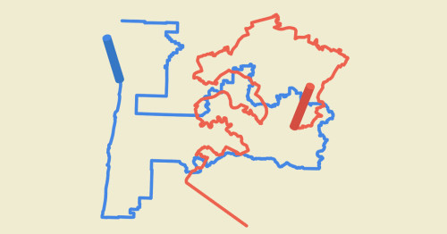
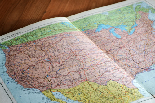
To better understand how the Census is used to determine Congressional representation in Congress, take a few minutes to explore the Electing the House of Representatives map. Be sure to carefully read the “How to Use This Map” section first, then take time to find each of the map’s features as you explore.
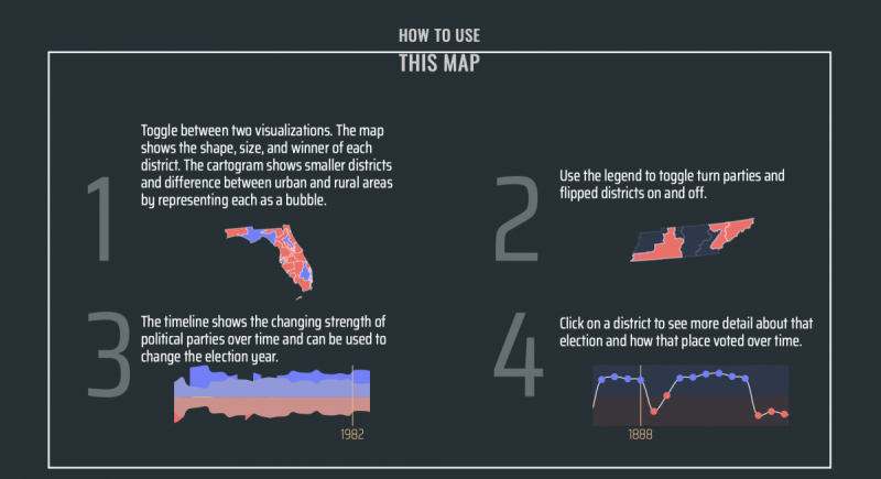

Electing the House of Representatives
Maps and visualizations of House elections for nearly two centuries.
dsl.richmond.edu
Spend some time toggling between the Map and Cartogram views. Locate your state and district in both views.
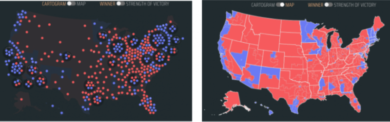
- What patterns do you see in your Congressional district as you toggle between both views?
- What questions do you have about the different ways the data is visualized on the map?
If you live in a smaller state, or one which is not very densely populated, you may choose to explore a neighboring state to get a better understanding of how the maps can change over time. Notice the use of red and blue in the map key to distinguish between the different political parties in control of each district.
Use the “Strength of Victory” to toggle between viewing the winners and to see how close each race was by state and district. When a state and or district has several close elections with mixed results over a few election cycles, some people refer to them as “purple,” or very close to the middle between both parties. This makes it difficult for both parties to predict which way future elections will be decided by the voters.
- What patterns do you see across the United States comparing the “red states” and “blue states?”
- Can you identify any “purple” states” from your exploration of the map so far?
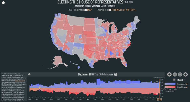
Now take time to use the slider tool located along the bottom of the map to view how Census data has changed voting patterns from previous decades.
- How does the map change as you move the tool from the 2018 midterm elections to previous election cycles?
- What do you notice as you slide the tool back every 10 years as it reflects the Census data from the era? (2010, 2000, 1990, etc)
- What happens when you slide it back to 1960? Earlier?
- What surprised you the most about the map?
- What are you still curious to learn more about related to the map?
The United States Census Bureau collected population data again in the year 2020. While the 2020 Census data and election data have not yet been added to this map, civic leaders have begun the process of redistricting in all 50 states. As you continue to explore the map, you may also view some connections here using excerpts in Bunk. This Bunk tag may also be interesting to explore.
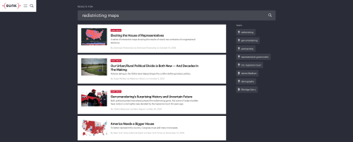
Bunk Tag: Redistricting
Rewiring American History
www.bunkhistory.org
- What predictions do you have about how the overall U.S map will change based on the most recent Census data from 2020?
- How do you think this process will look in your state?
- In your Congressional district?
The “Mapped Out” podcast follows the redistricting process as it has unfolded over the first half of the year 2021, as this “purple” state tries to redraw its Congressional district. Listen to episode one to learn about Wisconsin’s most recent efforts to tackle redistricting.
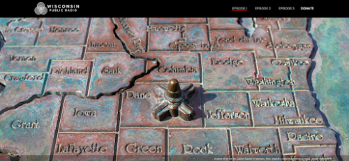
Mapped Out
“WPR Reports: Mapped Out” is a limited-run Wisconsin Public Radio podcast about the 2011 fight over legislative redistricting in Wisconsin — how it was supposed to go, how it really happened, and how those decisions impact Wisconsinites today.
www.wpr.org
Your teacher may provide you with a paper copy or ask you to make your digital copy of this podcast listening guide so you may take notes as you follow along.
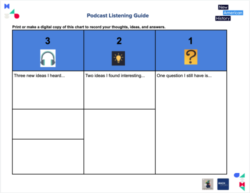
docs.google.com
Now return to the Electing the House of Representatives map. Take a few minutes to explore the state of Wisconsin, then compare it to your state. Select the “Show District Maps Over Time” in the box to the left of the slider tool.

(If you are currently using this learning resource and you live in Wisconsin, select another neighboring state to compare to your state).
- What “Aha!” moments did you have as you explore the data from WI and one other state?
- How has your thinking changed about Gerrymandering, either from exploring the map or based on what you learned from the “Mapped Out” podcast?
- Where might you find more information about redistricting efforts going on in your state?
Your teacher may ask you to record your answers or share your 321 Podcast Listening Guide answers as an exit ticket.
Explore:
Who draws the Congressional maps in each state, and how do they determine these districts?
The methods for redrawing the state Congressional voting maps in the redistricting process vary from state to state. This short video from Representable.org gives us a brief overview of the process.
The New York Times created a visualization to explain the redistricting process past and present. Take a few minutes to explore How Maps Reshape American Politics.
How Maps Reshape American Politics
We answer your most pressing questions about redistricting and gerrymandering.
www.nytimes.com
This blog entry from Ballotpedia gives us more insight into how this process can vary state by state, and includes a map with a summary of each state’s process.
Redistricting - Ballotpedia
Ballotpedia: The Encyclopedia of American Politics
ballotpedia.org
Read through the Ballotpedia blog entry independently, looking for examples of how the vocabulary used in this learning resource is included in the text to explain or describe the redistricting process. If your teacher permits, find a partner to reread using a paired reading strategy, taking turns reading each paragraph aloud to each other, pausing to clarify any unfamiliar words or ideas in each paragraph. If working remotely, your teacher may allow you to use a collaborative document such as Google Docs, Google Slides, or Padlet, or provide opportunities for collaboration using videoconferencing technology, such as breakout rooms via Zoom or Google Meet.
When you are finished reading, express your thinking about the process of redistricting as you work independently to complete the Color-Symbol-Image Graphic Organizer provided by your teacher, or make a digital copy to share your responses.
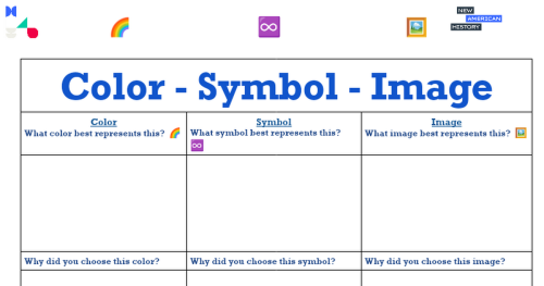
NAH template Color-Symbol -Image
Graphic Organizer
docs.google.com
Next, share your graphic organizer with your partner, discussing your answers.
If time permits, your teacher may allow your class to share their work more widely using a Gallery Walk, or if working remotely, a digital Gallery Walk using Google Slides or another collaborative document.
Your teacher may ask you to record your answers on an exit ticket.
Explain:
How does Gerrymandering influence partisan politics, and increase polarization between political parties?
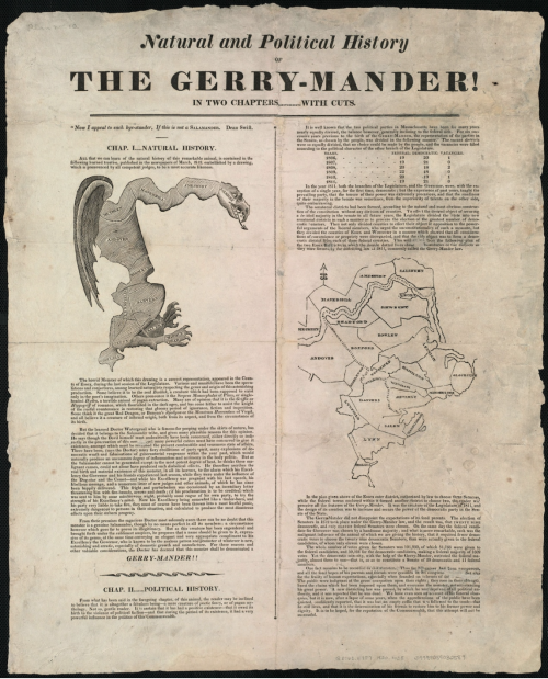
Redistricting and gerrymandering are as old as Congress itself. While it may seem we are living in “unprecedented times,” as the media often claims, members of Congress have resorted to similar tactics and have a long history of not getting along, dating back to our nation’s beginnings. Take a moment to analyze this newspaper article from c. 1820, which includes the original 1812 Gerrymander map that inspired the term, “Gerrymandering,” on the left, and a more realistic one of the region from the 1820s on the right.

collections.leventhalmap.org
Your teacher may provide a paper copy of this graphic organizer from the Library of Congress, or if working digitally, you may use this fillable .pdf link. Be sure to print or save your responses as a .pdf file to capture and save your responses.
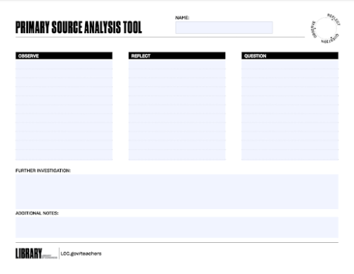
Primary Source Analysis Tool
Library of Congress
www.loc.gov
- What do you notice about the 1820 Gerry-mander! images of the two maps?
- How do they compare to the digital maps you previously viewed from Electing the House of Representatives and Ballotpedia?
For more historical context about Gerrymandering tactics, review this Explainer from the Brennan Center for Justice.
Gerrymandering Explained
The practice has been a thorn in the side of democracy for centuries, and with the new round of redistricting it’s a bigger threat than ever.
www.brennancenter.org
RetroReport created this video to help explain the history of Gerrymandering and partisan politics. View the video in Bunk.

Gerrymandering's Surprising History and Uncertain Future
Both parties play the redistricting game, redrawing electoral boundaries to lock down power.
www.bunkhistory.org
“There ought to be some line that you don't cross. How far would you go to control? Taking the advantage of the election is expected, but the prize of winning also has within its core responsibility — fairness and respect for the Rule of Law.”
Take a few minutes to explore another Bunk Tag, this time exploring connections for Gerrymandering. Begin with the same link in Bunk that you used to view the video.
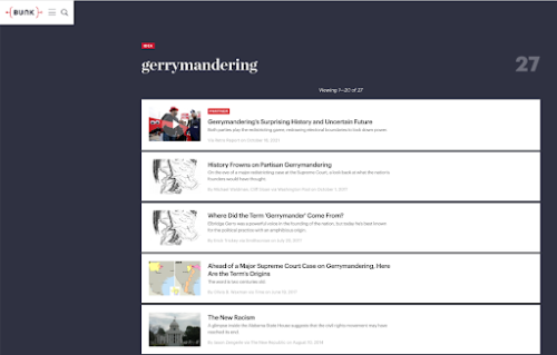
gerrymandering
Rewiring American History
www.bunkhistory.org
- What connections did you find that were similar to the Explainer, the video, or the results in your earlier search when you used the Bunk Tag for Redistricting?
- What new connections or ideas did you explore?
- What questions do you still have about Redistricting or Gerrymandering?
- Where might you find the answers to your questions?
- If you could create a NEW connection or Bunk Tag for either Redistricting or Gerrymandering, what would it be?
Explain your answer and share an interesting connection you made in Bunk using the existing tags. Your teacher may allow you to work with a partner, or if working digitally, provide a collaborative tool such as a Google Doc to share a link to the connection you made, or explain your answer as directed by your teacher.
Your teacher may ask you to record your answers on an exit ticket.
Elaborate:
What role does each branch of government play in influencing Congressional representation?
While the Census and redistricting are both required by the Constitution, the rules vary from state to state. In most states, the state legislature has the primary responsibility for redrawing both state and Congressional districts every 10 years following the Census. In many states, the executive branch, the Governor, is required to sign the new maps into law once a bill is presented, or they may veto the bill unless the state permits a legislative override. Because of the long history of Gerrymandering, many states are unable to reach a consensus on these redistricting maps, and eventually, the judicial branch will get involved as new maps are challenged in court by both political parties, special interest groups, or other concerned citizens.
Two of the most common Gerrymandering tactics, Packing, and Cracking, are the most frequently challenged in court. This video of The Redistricting Song illustrates how partisan politics often uses Gerrymanding tactics to decrease the influence of historically marginalized groups, particularly people of color, indigenous populations, and immigrants living in formerly redlined areas. While viewing the video, pay careful attention to the role of each branch of government in this process, and how the voices of everyday citizens are or are not being heard.
Compare and contrast TWO of the cities featured in the video and revisit their historic redistricting patterns using the Electing the House of Representatives map.
- Cleveland, OH
- Raleigh, NC
- Austin, TX
- Rochester, NY
- Jacksonville, Gainesville, or Orlando, FL
Take a few minutes to explore a summary of the 2018 Supreme Court Ruling from the Rucho v. Common Cause Gerrymandering case. (The complete ruling is found here.)
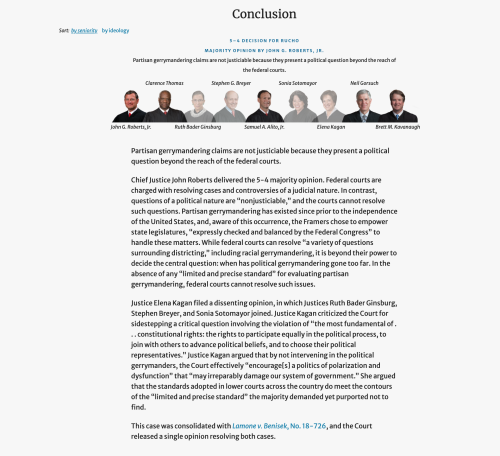
Rucho v. Common Cause
Oyez.org
www.oyez.org
Next, examine this quote from GeoCivics:
“In the case of Rucho v. Common Cause, the Supreme Court held: "Partisan gerrymandering claims present political questions beyond the reach of the federal courts." This means that the federal courts will not provide guidance to disenfranchised people due to the manipulation of district drawing. It is the responsibility of individuals at the state and local levels to be involved and discuss regulations cartographers use to make redistricting fairer. ”
- What arguments were presented before the court?
- How did the court rule?
- Did all Justices agree on the ruling?
- Whose interests were best served by the ruling?
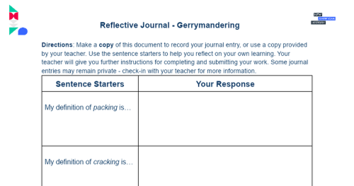
NAH Gerrymandering Reflective Journal
Directions: Make a copy of this document to record your journal entry, or use a copy provided by your teacher. Use the sentence starters to help you reflect on your own learning. Your teacher will give you further instructions for completing and submitting your work. Some journal entries may rem...
docs.google.com
Make a digital copy of this Reflective Journal, or use the copy provided by your teacher to record your thoughts about the video:
- What examples do you see in the video of packing? Explain packing in your own words
- What examples do you see in the video of cracking? Explain packing in your own words
- Take a few minutes to reflect on how one or more branches of government participate directly or indirectly in Gerrymandering (You may sketch your answer in the space provided.)
- Conclude your Reflective Journal by suggesting ways everyday citizens may contribute to fair voting and combat Gerrymandering.
Your teacher may ask you to submit your Reflective Journal as an exit ticket.
Extend:
How might citizens help shape the future of Congressional representation and combat Gerrymandering?
If this whole process of redistricting and reapportionment seems confusing, you are not the only one who thinks so! Luckily, many universities and civic organizations like GeoCivics, Districtr, Dave’s Redistricting, All About Redistricting, The Campaign Legal Center, and the Brennan Center spend a good bit of time tracking these rules and policies to help people living in each state make sense of the process.
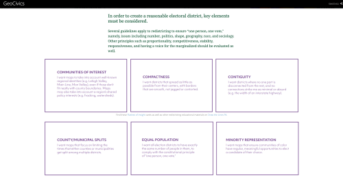
The founders included “The People” in the redistricting process for a reason. Communities of Interest are one element of the process to create a fair district.
Explore the "So, What Constitutes a Fair District?” section of this GeoCivics StoryMap. (You may need to scroll down to this section near the end.) Consider using the “Flashes of Insight” activity from Draw the Lines PA to guide discussion about redistricting criteria. The resource is available for download or as an online sorting game.
GeoCivics
This story map was created with the Story Map Cascade application in ArcGIS Online.
www.arcgis.com
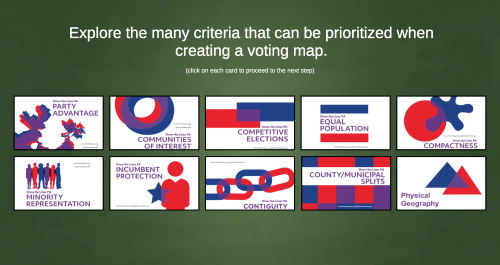
Flashes of Insight
Draw the Line PA with GeoCivics
geocivics.itch.io
Keeping these in mind, it is YOUR turn to become part of a Community of Interest, and become a redistricting cartographer! Visit the Districtr User Guide or start with the Training Slides to follow their step-by-step directions to create your own redistricting map. You can share and save your map within the platform or take a screenshot of your map.
We’d love to see your map! If your teacher or a trusted grown-up allows, share it with us via social media (links on our pages), or via email: editor@newamericanhist.org.
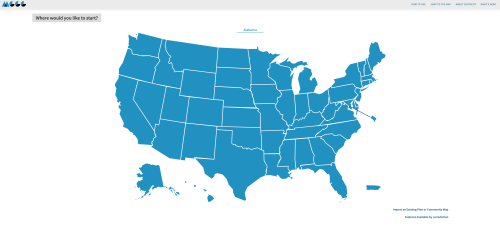
Districtr
The open web app for drawing districting plans.
districtr.org
Your teacher may ask you to share your map as an exit ticket.
Citations:
“50 State Guide to Redistricting.” Brennan Center for Justice. NYU Law, 2021. https://www.brennancenter.org/our-work/research-reports/50-state-guide-redistricting.
“‘Aha Moment’ -- New Dictionary Word for 2012 .” Merriam-Webster Dictionary, 2012. https://www.youtube.com/watch?v=MMDyYltQ2BM.
All About Redistricting. Loyola Law School, October 22, 2021. https://redistricting.lls.edu/.
“Bunk.” Bunk History. New American History, University of Richmond, 2021. https://www.bunkhistory.org/.
“CSI: Colour Symbol Image Choose a Colour That You Think ...” Thinking Pathways. Thinking Pathways, 2017. https://thinkingpathwayz.weebly.com/uploads/1/0/4/4/104440805/colour_symbol_image.pdf.
“Curious About Redistricting?” Representable. representable.org, December 20, 2020. https://www.youtube.com/watch?v=vUbZoyCCR44&list=PLMtKvNHC_zo3Q4o6kH04VlI4eaNPAfnB-&index=2.
“Dave's Redistricting.” Daves Redistricting. Dra 2020, 2020. https://davesredistricting.org/.
“EAD Interactive Roadmap.” Educating for American Democracy. Educating For American Democracy, March 16, 2021. https://www.educatingforamericandemocracy.org/the-roadmap/.
“Enumeration Clause | Constitution Annotated | Congress.gov ...” Constitution Annotated . Congress.gov, 2021. https://constitution.congress.gov/browse/essay/artI-S7-C1-1-1/ALDE_00001051/['jacobson',%20'v',%20'massachusetts'].
“How The Census Changed America.” youtube.com. Untold: Driving Force Institute, 2020. https://www.youtube.com/watch?v=a-uiW9B4gKU.
“Jim Gaffigan on Living in Unprecedented Times - Youtube.” youtube.com. CBS Sunday Morning, May 17, 2020. https://www.youtube.com/watch?v=GOQx9eZUurg.
Johnson, Bridgit Bowden and Shawn. “Redistricting Is Underway in Wisconsin. What Is It, Anyway?” Mapped Out . Wisconsin Public Radio, October 13, 2021. https://www.wpr.org/mappedout/redistricting-underway-wisconsin-what-it-anyway.
LaDale Winling, Robert K. Nelson, et al., “Electing the House of Representatives,” American Panorama, ed. Robert K. Nelson and Edward L. Ayers, accessed November 3, 2021, https://dsl.richmond.edu/panorama/congress.
MGGG Redistricting Lab. Districtr. MGGG Redistricting Lab , 2021. https://districtr.org/.
"Rucho v. Common Cause." Oyez. Accessed November 2, 2021. https://www.oyez.org/cases/2018/18-422.
Russell, John, Cutler, James, and Gardner, Simon. "Natural and political history of the Gerry-mander!." Map. 1813. Norman B. Leventhal Map & Education Center, https://collections.leventhalmap.org/search/commonwealth:3t947b80f.
“Teacher's Guide: Analyzing Maps | Teacher Resources - Library of Congres.” Analyzing Primary Sources. Library of Congress, 2021. https://www.loc.gov/static/programs/teachers/getting-started-with-primary-sources/documents/Analyzing_Maps.pdf.
“The Battle for Votes: Gerrymandering.” Retro Report. RetroReport, October 21, 2021. https://www.retroreport.org/education/video/the-battle-for-votes-gerrymandering/.
“The Redistricting Song .” ProPublica, October 31, 2011. https://www.youtube.com/watch?v=bh4qAJDUOcc.
Theobald, Rebecca. “Welcome to GeoCivics.” GeoCivics. University of Colorada Colorado Springs, 2017. https://geocivics.uccs.edu/.
View this Learning Resource as a Google Doc