This work by New American History is licensed under a Attribution-NonCommercial-ShareAlike 4.0 (CC BY-NC-SA 4.0) International License. Permissions beyond the scope of this license may be available at newamericanhistory.org.
Not Even Past: Redlining & Public Health
Read for Understanding
The novel coronavirus pandemic has worsened many racial health inequities that existed well before this public health crisis. Americans of color have disproportionately been infected by and died from COVID-19. They are more likely to have underlying health conditions that increase the risk of severe illness from COVID-19. While the pandemic has pushed racial health inequities into the national spotlight, the underlying differences in social, economic, and environmental conditions that give rise to inequities in COVID-19 infection, transmission, and severe illness are far from new. This learning resource explores the connections between redlining and public health.
Key Vocabulary
Dole - the act of giving out food, clothing, supplies, or money to the needy; doling out or distributing needed goods or services
Food desert - an area with limited access to affordable, nutritious food
Food insecurity - lack of consistent access to enough food for an active, healthy life
Home Owners’ Loan Corporation (HOLC) - an agency created in 1933 by U.S. President Franklin D. Roosevelt’s New Deal that attempted to prevent foreclosures by refinancing home mortgages in default; created a color-coded grading system that assessed the credit-worthiness of city neighborhoods
The New Deal - President Franklin D. Roosevelt’s program to help solve the economic problems triggered by the Great Depression
Redlining - the practice of mortgage lenders drawing red lines around portions of a map to indicate areas or neighborhoods in which they do not want to make loans.
Social Vulnerability - the potential negative effects on communities caused by external stresses on human health
Social Vulnerability Index - a measurement of social vulnerability that uses U.S. Census data
StoryMap - a web-based visualization integrating maps, text, images, and multimedia elements
Urban heat island - a phenomenon where a city or section of a city experiences much warmer temperatures than nearby rural areas
Engage
How can where you live affect your health?
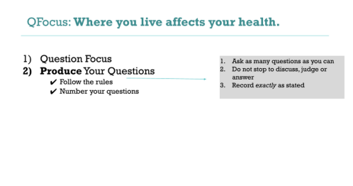
In a small group of three or four as directed by your teacher, use the Question Formulation Technique to explore the following QFocus (Question Focus) prompt. (Note: If working remotely, you may use breakout rooms through videoconferencing, or share via a collaborative document such as Google Docs or Google Slides.)
Where you live affects your health.
After completing Steps 1 - 4, have each group choose their best questions, using Step 5. Ask a representative from each group to share that question.
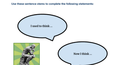
After participating in the QFT, reflect on your learning in your group using the “I Used to Think...Now I Think” Thinking Routine:
- I used to think ________ about how where you live affects your health.
- Now, I think _______ about how where you live affects your health.
BACKGROUND: During the Great Depression, the federal government created the Home Owners’ Loan Corporation (HOLC) to help homeowners. The HOLC created a mapping system for more than 200 cities that identified the safest and riskiest neighborhoods for doling out housing loans. The mapping system used the practice of redlining and favored white residents over Black residents and immigrants. Today, many of the same areas that were redlined are experiencing negative health outcomes.
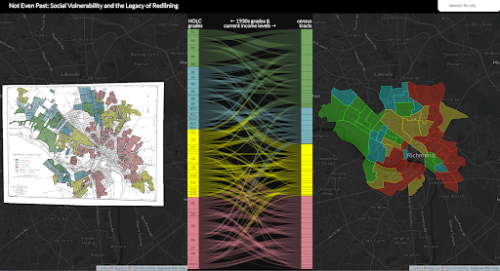
To more clearly understand the connection between redlining and health outcomes, as well as the narrative map that you will analyze, called “Not Even Past: Social Vulnerability and the Legacy of Redlining,” read the introduction independently.
Then, answer these questions in a small group as directed by your teacher:
- How is racial residential segregation related to health outcomes?
- How did the Home Owners' Loan Corporation redline neighborhoods, and how has this led to health disparities?
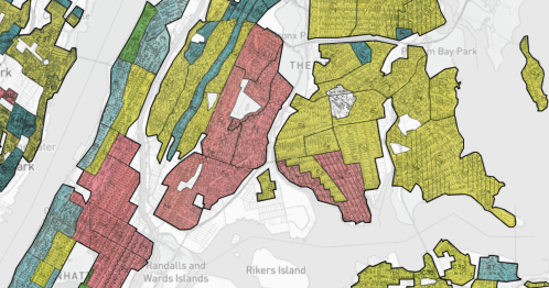
- What will the two sides of the map show?
Your teacher may ask you to record your answers on an exit ticket.
Explore
How are redlined areas of American cities more socially vulnerable?
The legacy of racial residential segregation and redlining includes disparities in educational opportunities, transportation infrastructure, and access to healthcare. The “Not Even Past” map connects redlining data from the 1930s to present-day health, economic, and demographic data from the Center for Disease Control and the U.S. Census. It uses the CDC’s Social Vulnerability Index, which measures how well a community can prepare for, respond to, and recover from human and natural disasters.
Take a few minutes to explore the map, including the ways data is visualized.
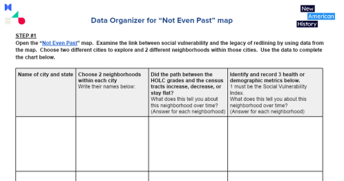
After you’ve explored, examine the link between social vulnerability and the legacy of redlining by making a copy and completing this Data Organizer.
Your teacher may ask you to record your answers on an exit ticket.
Explain
How has the practice of redlining affected public health and safety?
This Bunk Collection contains resources that delve deeper into the long-term effects of redlining on urban areas, such as air pollution, increased flooding, food deserts, increased temperatures, and more.
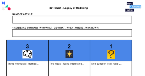
From the collection, choose 3 resources that interest you. Then, make a copy and complete this 3-2-1 graphic organizer as you read, one for each item.
After you complete all three of the graphic organizers, share your ideas within small groups or with the whole class.
If working remotely, you may use breakout rooms through videoconferencing or share via a collaborative document such as Google Docs or Google Slides.
Your teacher may ask you to record your answers on an exit ticket.
Elaborate
How is redlining linked to food insecurity and urban heat islands?
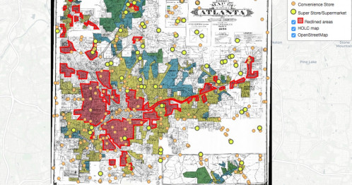
Urban neighborhoods that were redlined starting in the 1930s face present-day challenges that have been linked to the practice. Two such social and environmental challenges are food insecurity and urban heat islands. What specifically caused these challenges and how are they impacting people in redlined neighborhoods?
To learn more, explore this Bunk Connection by reading “From Food Deserts to Supermarket Redlining” and “How Decades of Racist Housing Policy Left Neighborhoods Sweltering.”
Before you read, review the questions in the “Take Note” Thinking Routine. After you read, you will choose one of the following questions to answer. Don’t try to take notes as you read; focus instead on becoming fully engaged in the text:
- What is the most important point?
- What are you finding challenging, puzzling, or difficult to understand?
- What question would you most like to discuss?
- What is something you found interesting?
When you finish reading, answer one of the Take Note questions above. Your teacher may provide access to a Google Docs discussion board, or allow you to collaborate on a Google Slides set. Your teacher will debrief by reading back student responses to the class and asking follow-up questions or by asking you to turn and talk to a partner to share your answers.
Lastly, you will end with a discussion of this Exit Question, using ideas from the readings:
How is redlining linked to food insecurity and urban heat islands, and how have these challenges affected people in redlined neighborhoods?
Your teacher may ask you to record your answers on an exit ticket.
Extend
How can we reverse the negative effects of redlining?
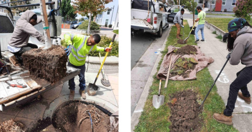
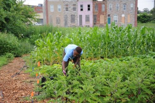
INTRO READING: Scholars and policy experts have suggested many ideas to reverse the negative effects that redlining has had on the health and vitality of neighborhoods, especially predominantly Black neighborhoods. Read these two articles: “Tree by Tree, a Community Works to Reverse Its Racist Housing Legacy” and “Urban Agriculture: Lessons from Baltimore and Beyond.” After you finish, answer these questions:
- Identify the negative health effect addressed in the article and summarize the article’s solution to it.
- How effective do you think this solution is?
CRAFTING A PROPOSAL: Conduct research to propose a solution for a city that is included in the American Panorama map, Mapping Inequality: Redlining in New Deal America.
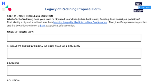
To organize your proposal, first, identify a city, and then identify an area that was redlined and summarize the description given. Next, identify a present-day health or social problem you think this redlined area has based on your exploration of the American Panorama maps, and research articles that address a plan for taking action toward a solution. The last piece of your proposal is to draft an email to your city councilors laying out why you think your city or town needs this solution and what it would take to execute the proposal. Complete this Proposal Form.
Your teacher may ask you to record your answers on an exit ticket.
Citations:
Anderson, Meg. “Racist Housing Practices from the 1930s Linked to Hotter Neighborhoods Today.” NPR. NPR, January 14, 2020. https://www.npr.org/2020/01/14/795961381/racist-housing-practices-from-the-1930s-linked-to-hotter-neighborhoods-today.
Capps, Kriston, and Christopher Cannon. “Redlined, Now Flooding.” Bloomberg.com. Bloomberg. Accessed July 7, 2022. https://www.bloomberg.com/graphics/2021-flood-risk-redlining/.
“Covid-19 and the Color Line.” Boston Review, April 30, 2020. https://bostonreview.net/articles/colin-gordon-walter-johnson-jason-q-purnell-jamala-rogers-covid-19-and-color-line/.
“How Decades of Housing Discrimination Hurts Fresno in the Pandemic.” Retro Report, April 27, 2022. https://www.retroreport.org/video/how-decades-of-housing-discrimination-hurts-fresno-in-the-pandemic/.
Plumer, Brad, Nadja Popovich, and Brian Palmer. “How Decades of Racist Housing Policy Left Neighborhoods Sweltering.” The New York Times. The New York Times, August 24, 2020. https://www.nytimes.com/interactive/2020/08/24/climate/racism-redlining-cities-global-warming.html.
Purtell, Joe. “Tree by Tree, a Community Works to Reverse Its Racist Housing Legacy.” Mother Jones, August 17, 2021. https://www.motherjones.com/environment/2021/08/redlined-city-striving-green-itself-groundwork-richmond-california-trees-environmental-justice-black-brown/.
Robert K. Nelson, LaDale Winling, Richard Marciano, Nathan Connolly, et al., “Mapping Inequality,” American Panorama, ed. Robert K. Nelson and Edward L. Ayers, accessed July 7, 2022, https://dsl.richmond.edu/panorama/redlining.
Shannon, Jerry. “From Food Deserts to Supermarket Redlining: Making Sense of Food Access in Atlanta.” Atlanta Studies, March 11, 2022. https://atlantastudies.org/2018/08/14/jerry-shannon-from-food-deserts-to-supermarket-redlining-making-sense-of-food-access-in-atlanta/.
The Digital Scholarship Lab and the National Community Reinvestment Coalition, “Not Even Past: Social Vulnerability and the Legacy of Redlining,” American Panorama, ed. Robert K. Nelson and Edward L. Ayers, https://dsl.richmond.edu/socialvulnerability.
UNA-NCA, Advocacy @. “Urban Agriculture: Lessons from Baltimore and Beyond.” Medium. UNA-NCA Snapshots, November 12, 2020. https://medium.com/una-nca-snapshots/urban-agriculture-lessons-from-baltimore-and-beyond-5c1269effe03.
Zhong, Raymond, and Nadja Popovich. “How Air Pollution across America Reflects Racist Policy from the 1930s.” The New York Times. The New York Times, March 9, 2022. https://www.nytimes.com/2022/03/09/climate/redlining-racism-air-pollution.html.


